


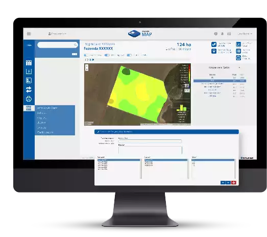

FalkerMap is an online system developed for you to easily create fertility and variable rate recommendation maps.
Simplicity of use
The operations are guided by virtual assistants that minimize the learning curve. Parameters are available in optional settings for advanced users.
Practicality
Have control over the imported files formats. Configure and save a pattern from tables received from the laboratory for easy and fast importations.
Configurable
You can configure and save the colors and value ranges of the maps according to your preferences and create a pattern to your works.
Simple
Direct
Intuitive
All functions can be easily accessed due to the simplified interface and the unique graphical system for editing agronomic formulas improves the efficiency in generating maps and recommendations.
Simple
Direct
Intuitive
All functions can be easily accessed due to the simplified interface and the unique graphical system for editing agronomic formulas improves the efficiency in generating maps and recommendations.
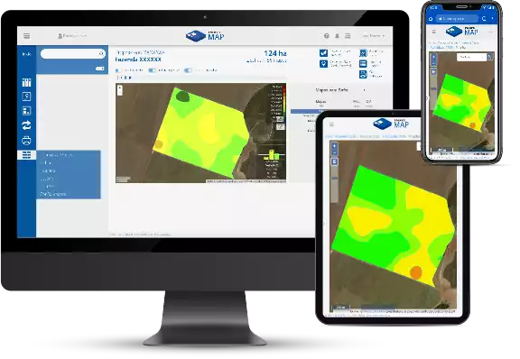
Security and flexibility of a full online system.
Security and flexibility of a full online system.
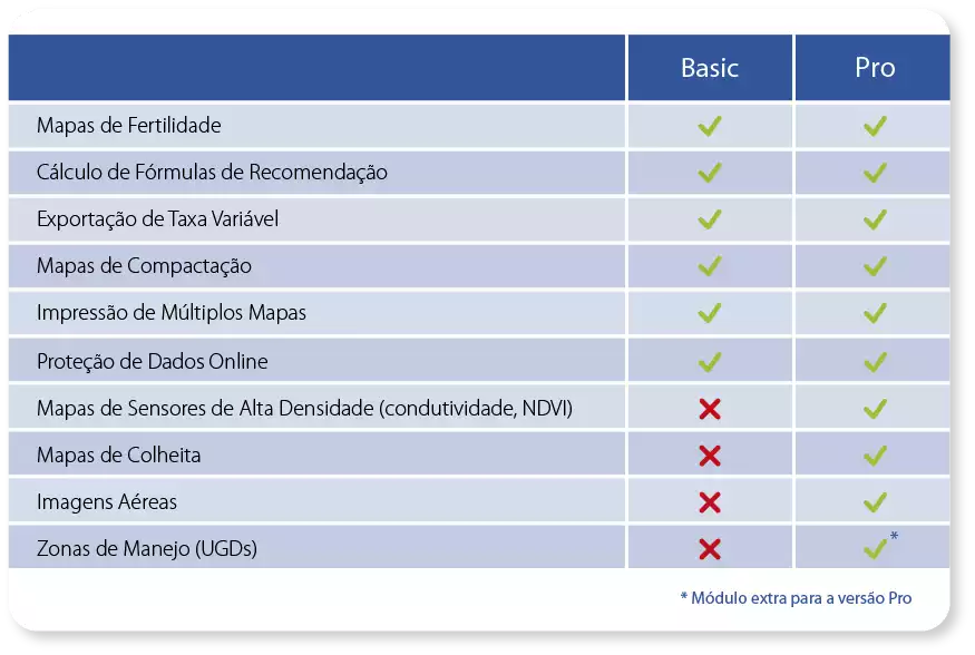
Functionalities
Fertility maps
Transforms soil laboratory analysis into easy-to-read maps for precise diagnosis.
Variable rate maps
Generates variable rate maps in Shape format for use in application controllers.
Agronomic formulas
Exclusive system for creating, editing, and customizing agronomic formulas for application calculations. The results are presented graphically through diagrams that do not require programming knowledge..
Interpolation
FalkerMap performs the interpolation through kriging. This advanced technique is ideal for processing substantial amounts of data and generates more reliable results in the area.
Seed population maps
Generation of seed application maps based on multiple data layers and custom formulas that can maximize productivity according to the potential of each field area.

High density maps
Harvest maps are essential for analyzing the distribution of productivity. This module supports data in shape format and processes the most modern precision agriculture resources such as conductivity maps, NDVI, and satellite images.
Working with management zones
The software's differential lies in the ease of working with management zones (or Differentiated Management Units - UGDs). FalkerMap allows the delimitation of zones according to the amount of data chosen with definition of maximum and minimum size. It is also possible to define sampling points and generate diagnostic and application maps. The use of UGDs instead of grids provides a sectoral management by similarity of parameters.
Request Quote
If you prefer, fill in the form and we will contact you shortly.
 Contact Us
×
Fill in the information to chat with one of our consultants
If you prefer, for technical support service, click the button below